

By Time of Hindustan News Desk
Introduction: Why Drones using for Aravalis Surveillance in Haryana?
Tucked away in the shadow of bustling cities like Gurugram and Faridabad lies one of India’s oldest and most fragile natural ecosystems—the Aravalis. These ancient hills are not just home to rare wildlife and native forests; they’re also a crucial barrier against desertification and urban heat. But in recent years, the region has turned into a battleground—illegal mining, rampant deforestation, and unchecked encroachments have ravaged the landscape.
In a groundbreaking move, the Haryana government has deployed an advanced drone and satellite surveillance system to monitor and protect the Aravalis. This program, hailed as a first-of-its-kind in India for forest and mining enforcement, brings cutting-edge technology to the forefront of environmental governance.
And it all begins with a silent drone, hovering high above the hills—watching, mapping, and recording the truth.
Why the Aravalis Need Surveillance More Than Ever
The Aravalis, believed to be over 1.5 billion years old, stretch across four Indian states—Delhi, Haryana, Rajasthan, and Gujarat. In Haryana, these hills stretch across Nuh, Gurugram, Faridabad, Rewari, and Mahendragarh, serving as the region’s final remaining green lung.
But despite multiple court orders and protective laws, illegal mining continues to gouge out the hills—one dump truck at a time.
🔴 The Crisis in Numbers:
- Over 7,000 hectares of forest cover lost in Haryana over the last decade
- Hundreds of illegal mining sites exposed in Nuh and Faridabad
- Local water tables falling by 3–5 meters annually in mining-hit zones
- Displacement of wildlife including leopards, porcupines, and migratory birds
The traditional enforcement system—boots on the ground, limited staff, delayed response—has failed to keep pace with how quickly the damage occurs. Illegal miners operate at night, move swiftly, and use political cover to evade action.
That’s where Aravalis surveillance in Haryana steps in as a game-changer.
How Aravalis Surveillance in Haryana Works: Tech Meets Terrain
Introduced as part of the DRIISHYA initiative (Drone Imaging and Information System of Haryana), the monitoring approach utilizes a powerful blend of high-resolution drone visuals, satellite imagery, GIS-based mapping, and AI-driven alert systems to enhance surveillance and land tracking.*.
🛰️ Key Components:
- Drones: Equipped with real-time imaging and GPS tagging
- Satellite Imagery: Tracks long-term land-use changes
- Geospatial Dashboard: Managed by HARSAC (Haryana Space Applications Centre), allowing district officials to view encroachments, vegetation loss, and mining activity
- Instant Alerts: Automated messages to forest, mining, and revenue officers
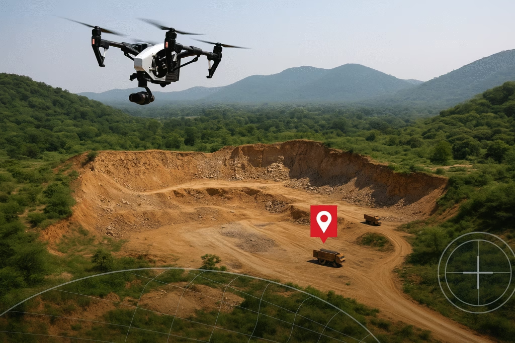
Each week, drones fly across known hotspots like Tauru, Nuh, and Sohna, capturing detailed images of the terrain. These are cross-verified with satellite data to detect any change in land cover, movement of heavy machinery, or fresh excavation sites.
A red mark appears on the GIS map—and within minutes, a team is alerted.
According to officials, this “eyes-in-the-sky” system has already reduced illegal mining cases by over 40% in certain zones.

From Sky to Soil: Stories from the Ground
To understand the real impact, Time of Hindustan visited the Tauru block of Nuh district, one of the worst-affected areas.
👨🌾 Case Study: Caught by the Drone
In April 2025, a drone flying over a barren patch near Ghasera village spotted freshly dug trenches and the movement of trucks. Within 48 hours, a joint team of forest and mining officers reached the site and seized machinery worth ₹1.2 crore.
Villagers nearby say this is the first time the government responded before the damage was done.
“Earlier, they would come only after we protested. Now, the drones see everything,” says Shabnam, a local farmer.
Even miners have noticed the difference.
“We can’t work in peace now. The sky is always watching,” a local operator anonymously admitted.
Local NGO activists, like Green Hills Foundation, also praise the transparency the program brings.
“It’s no longer a battle of proof. The drone images speak for themselves,” says Rohan Malik, a field coordinator.
The Legal Edge: Can Drones Be Evidence in Court?
One big question remains: Can drone footage be used as admissible evidence in legal cases against encroachers and miners?
The Haryana government says yes. The Geospatial Evidence Policy, framed in 2023, allows use of authenticated satellite and drone imagery in revenue disputes and environmental violations.
Already, over 85 FIRs have been registered in 2025 alone based on drone data.
In Nuh, this surveillance has helped:
- Enforce forest conservation rules
- Identify encroachments for eviction
- Build cases for prosecution faster
This has made Aravalis surveillance in Haryana not just a preventive tool—but a prosecution powerhouse.
Challenges Ahead: Tech Alone Isn’t Enough
While this surveillance system is revolutionary, it’s not without hurdles.
⚠️ Key Challenges: Aravalis Surveillance in Haryana
- Drone coverage is still limited to select districts
- Risk of political interference in action taken
- No clear policy yet for community data access or public accountability
Experts warn that technology must go hand-in-hand with stronger environmental policy, grassroots awareness, and legal reforms.
“Surveillance can detect, but it cannot protect unless there is swift action,” says Prof. Ashok Vats, a climate policy researcher.
READ MORE. :Vanishing Villages in India: The Silent Disappearance of Rural Life
A Model for India’s Environmental Governance?
The success of Aravalis surveillance in Haryana is attracting attention from other states. Rajasthan is reportedly considering a similar system for its protected forest zones, and even Maharashtra is exploring drone use in tribal forest reserves.
Why is this so important?
Because India loses over 1.5 million hectares of forest annually, much of it to unreported land-use changes, encroachments, and illegal activity.
A real-time, tech-enabled environmental monitoring network can help:
- Achieve India’s carbon neutrality targets
- Preserve biodiversity
- Enforce Supreme Court and National Green Tribunal (NGT) orders
- Empower local communities with data access
Conclusion: A Watchful Sky Over the Aravalis
The Aravalis have stood tall for over a billion years—but the threats they face today are unlike anything before. Mining mafias, illegal builders, and climate change are carving away their soul.
But for the first time, the hills aren’t alone.
With drones in the sky, satellites in space, and a digital eye on every acre, Haryana’s battle to protect the Aravalis may finally be turning in nature’s favor.
Still, this is just the beginning. The real test will be whether we, as a society, can match technology with the will to act.
💬 What Do You Think?
Have you seen changes in your area due to illegal mining or encroachments? Do you think Aravalis Surveillance in Haryana should expand?
Comment below and let your voice be heard. And FOLLOW US ON FACEBOOK
[…] READ : Aravalis Surveillance in Haryana: Drones and Satellites Watch Illegal Mining […]